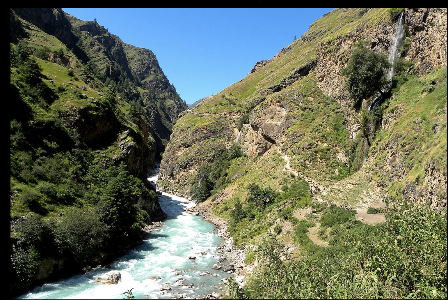
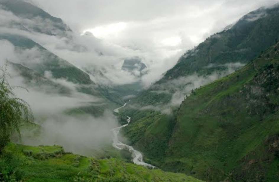
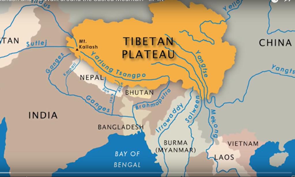
The Karnali rises from Mt. Kailash on the Tibetan Plateau, and flows 671 miles to its confluence with the Ganges River in India. The river provides water for millions of people, provides for fish and wildlife resources and has a high value for ecotourism especially in the form of whitewater rafting and as an approach corridor to the Sacred Mt. Kailash. These ecological services sustain livelihoods throughout the Karanli River Basin. An ancient river, the Karnali was in place as the Himalayan Mountains were thrust up by the collision of the Eurasian and the Indian tectonic plates. As the mountains rose, the river downcut into the landscape, the sinuous channel already in place. Hard rock ledges, ancient and current day landslides create steep stream gradients, boulder strewn reaches and world-class whitewater rapids. Fed by glacial meltwaters and strong monsoon rains, this powerfully erosive river provides water, nutrients and sediments to the lands along its path providing fertile agricultural plains.
The Karnali, along with three other sacred rivers, the Ganges, the Indus (Sutlej), and the Brahmaputra (Yarlung Tsangpo) all initiate from within 100 km (66 miles) of the slopes of Mt. Kailash on the Tibetan Plateau and supply food and water to billions of people in China, Nepal and India.
The Threat of a New Dam and Reservoir
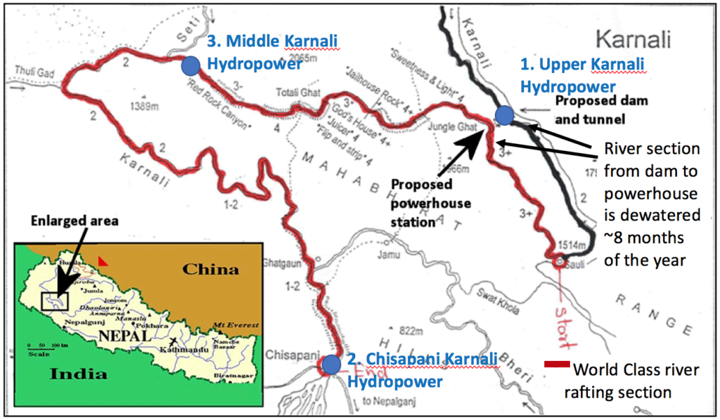
Three hydropower dams are planned for the main stem of the Karnali River, with another 40 proposed on tributary streams throughout the watershed. Construction of hydropower at this scale will irreversibly affect aquatic species habitats, migrations and ultimately their survival. The majority of the power provided by these dams will be exported to neighboring nations while Nepal will bear the social and environmental costs.
Environmental & Social Risks of Hydropower Development
Hydropower development has multiple environmental and social consequences if not based on a strategic planning process. The risks include:
- Poor quality environmental assessments that often disregard environmental risks especially to native fishery resources
- Dams that prevent migratory fish from reaching spawning grounds and that alter aquatic species habitats
- Road blasting for dams, and road access in general, if not well designed that exacerbates landslide risk
- Acquisition of high-value agricultural lands that disrupts local livelihoods
- Loss of native flora and fauna that impacts biodiversity and the human communities that depend on it
- False promises to locals of the benefits they will receive from construction and operation of dams that degrades trust and social structures
- Corruption in large infrastructure projects that results in low-quality construction practices
The Potential for Natural Disasters in Nepal is Among the Highest in the World
Earthquakes are a given in Nepal due to its location on the still moving Indian and Eurasian continental plates. The rising Himalaya and weak geology result in landslides. Monsoon rains result in significant flooding. Natural disasters have the following effects on dams:
Earthquakes
- Trigger landslides and rockfall
- Directly damage dam infrastructure
- The Gorkha earthquake of 2015 put 42 mega and small hydropower plants out of operation, one tenth of Nepal’s total energy generating capacity was damaged
Landslides
- Directly damage dam infrastructure (i.e falling boulders causing cracks)
- Block rivers creating dam-break flood events
- Deliver high sediment loads (some of the highest in the world) to the stream channel rapidly filling reservoirs and degrading
- Damage electrical transmission lines, road, and village infrastructure
Floods
- Large storms overpower dam capacity to control flows
- Carry large amounts of sediment into hydropower reservoirs